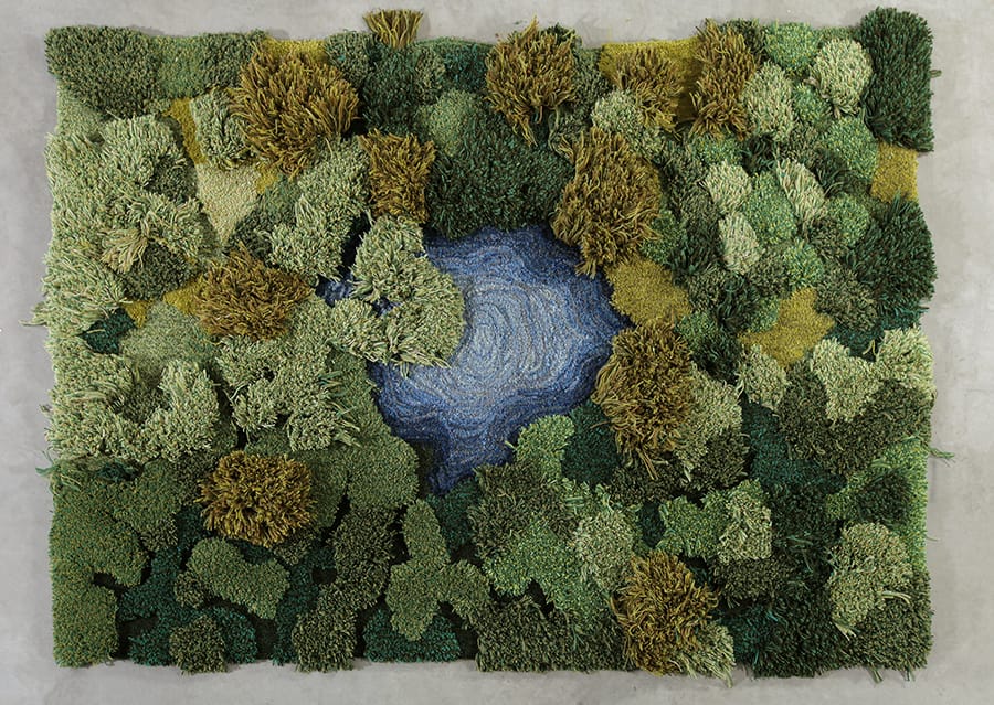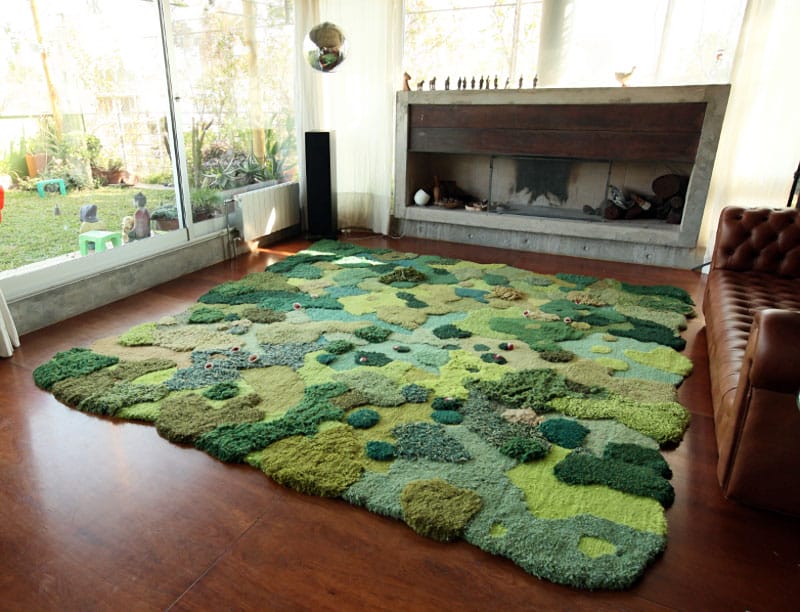
Florian Pucher Turns Aerial Photos into Plush Carpeting
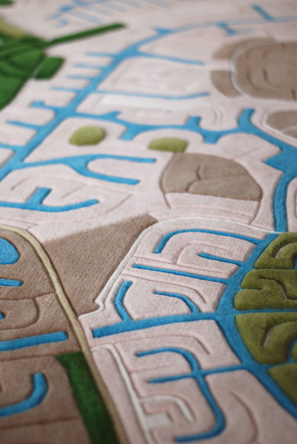
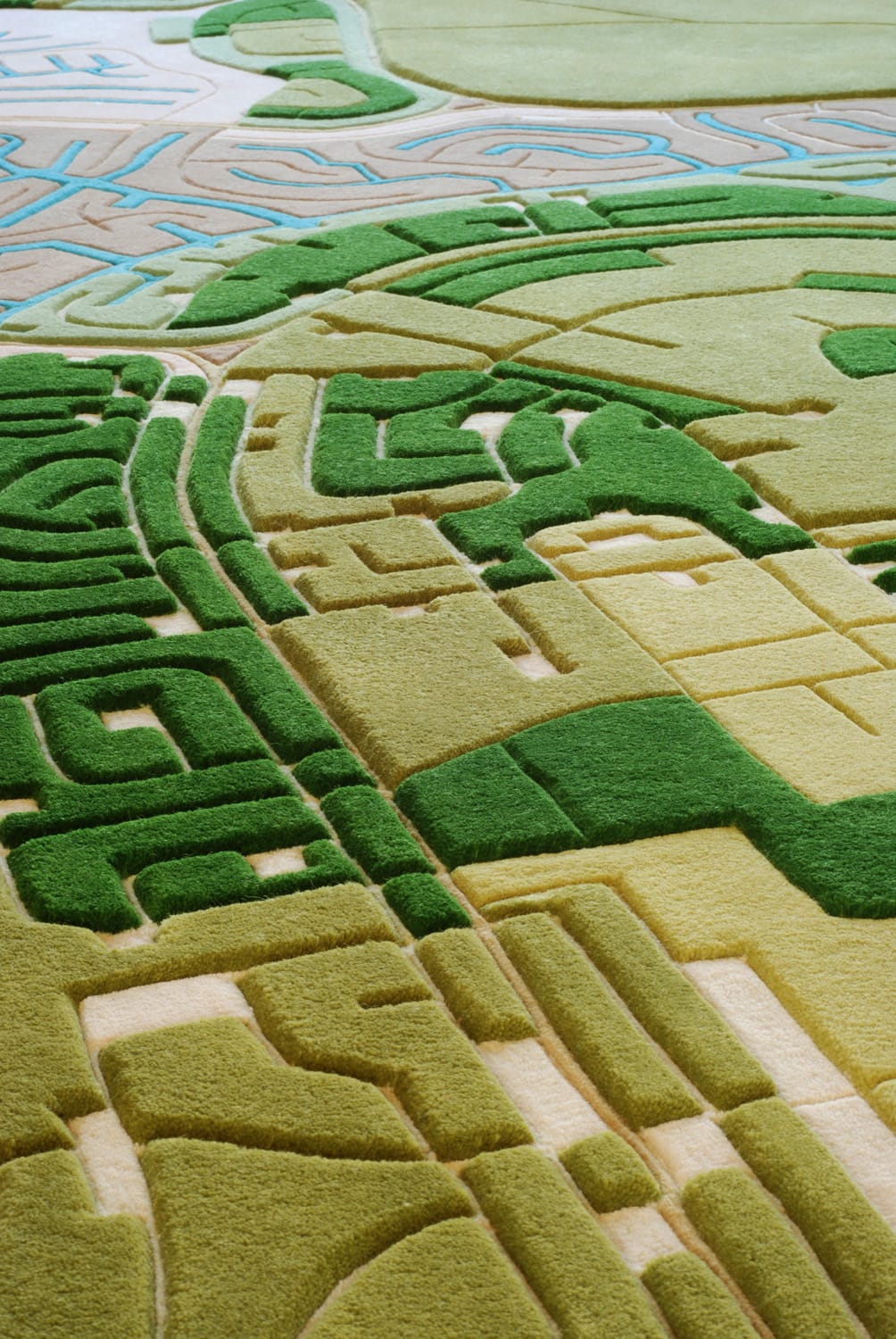
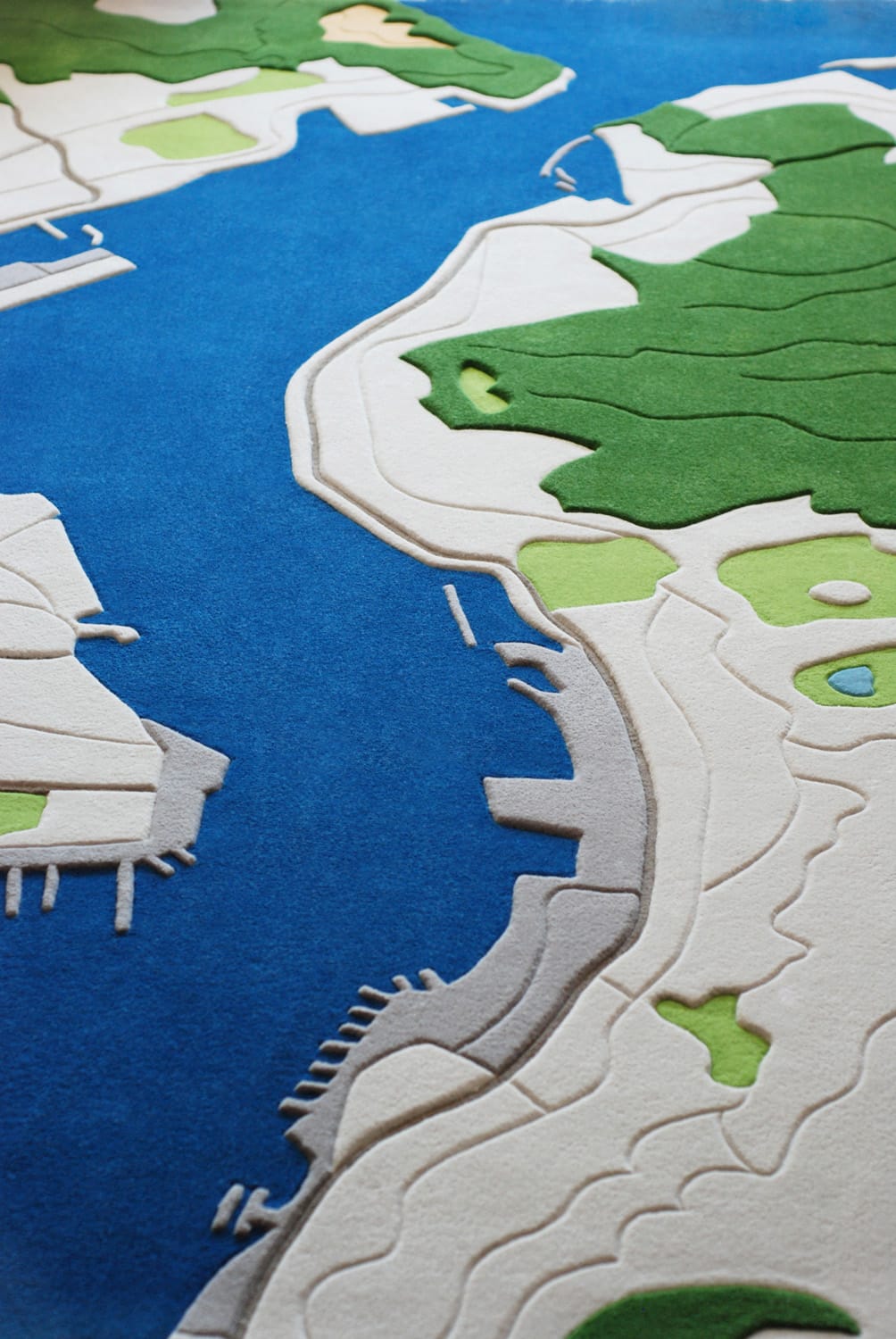
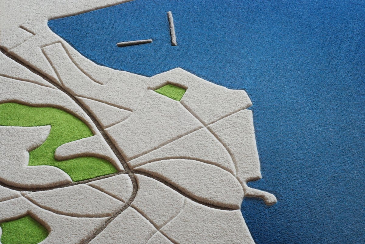
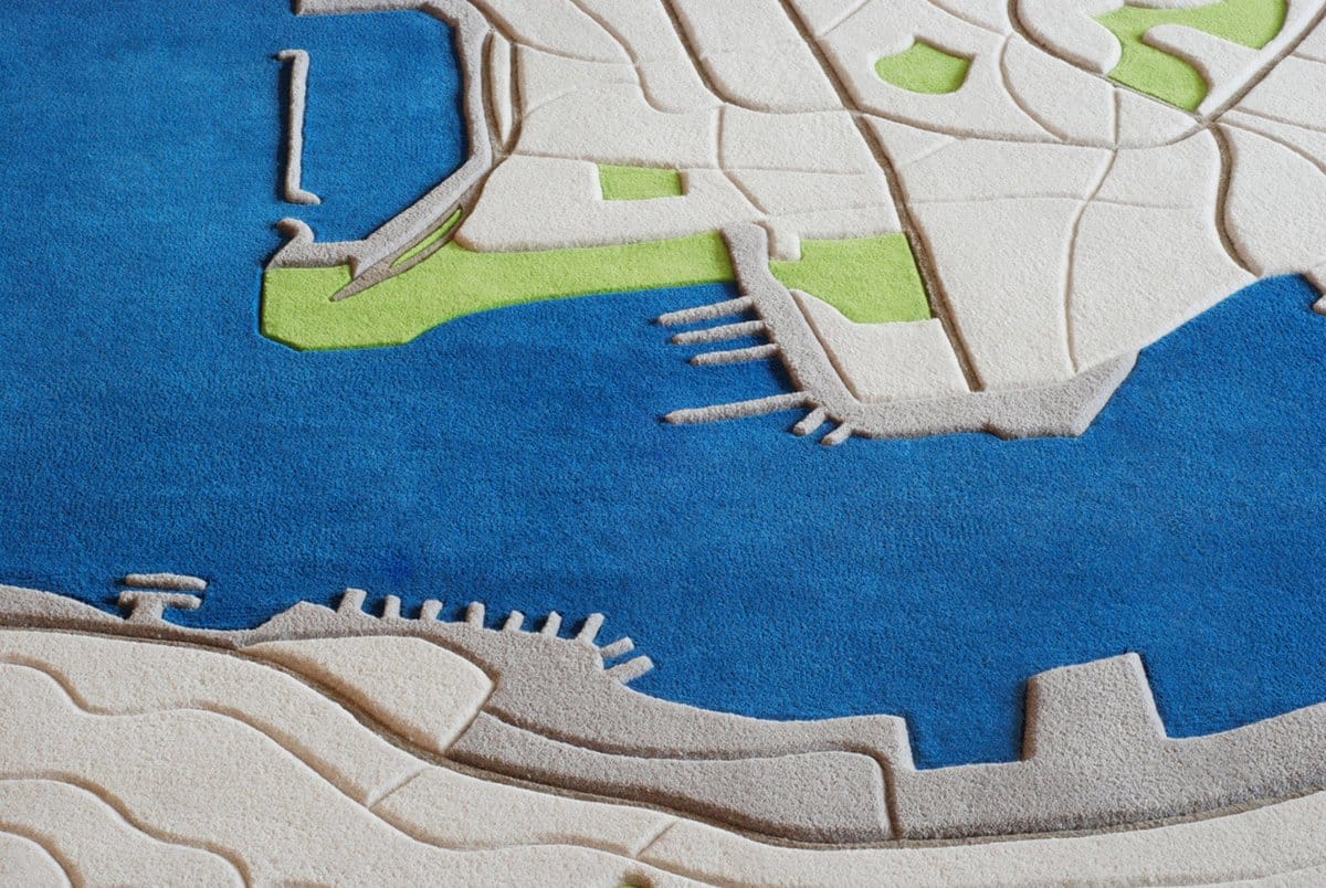
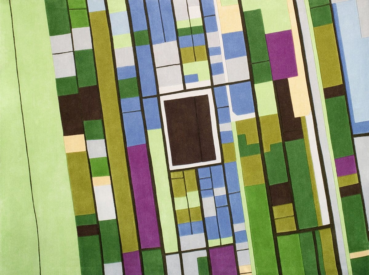
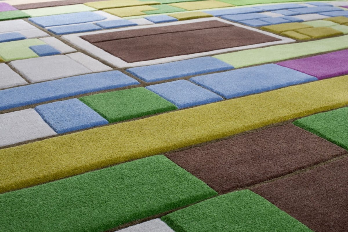

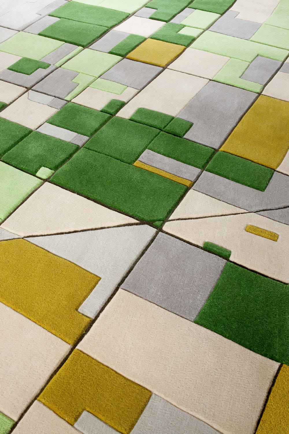
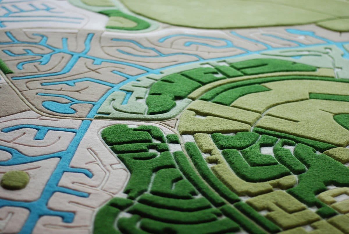
From a young age Florian Pucher was always fascinated by landscapes underneath and how blissful and beautiful our world looks from above. “I have always loved to travel and tried to always get window seats on planes,” said the Beijing-based Austrian architect who even avoided travelling by night in order to see as many different landscapes as possible. Pucher is now turning his childhood obsession into LANDCARPET: a series of rugs modeled after birds-eye-view aerial photographs of land.
Pucher uses various online mapping services to pinpoint locations of interest and then does picture searches to get a feel for the colors and elevations. He sometimes coincidentally will stumble upon satellite imagery or maps, which may lead to a new rug design. “Some countries are very easily recognizable through their methods of farming and that has always intrigued me,” Pucher tells us. “Furthermore as an architect and master planner I constantly get to see and look through site surveys, aerial images and city plans which have further sharpened my eye for distinguishable patterns and different layers.”
Pucher’s LANDCARPETs are signed and hand tufted in limited editions of 88 pieces. You can purchase one directly through his website. (via Yatzer)